✶ Welcome
to the
Chicago
Street Grid
The Street Grid: A Blueprint for Chicago
Chicago is widely considered to have one of the world’s best and most consistent street grids. It is one of the few cities in the world designed on a strict mathematical grid. From State and Madison to the city limits, its streets follow a logical, predictable system that makes navigation without a map possible for anyone who knows the formula.
The Center of the Grid
Everything begins at the intersection of State and Madison in the Heart of the Loop.
- State Street divides the city between East and West.
- Madison Street divides the city between North and South.
From this single point, the city unfolds in a predictable pattern with most streets running North/South or East/West.
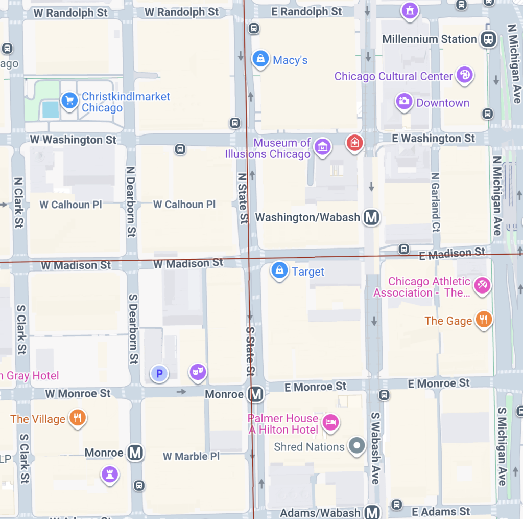
Street Names: Predirectionals
- North/South addresses are determined by their distance from Madison. Streets north of Madison Street have the prefix “N” and those south of Madison Street start with “S.”
- East/West addresses are determined by their distance from State. Streets east of State Street have the predirectional “E” and those west of State Street have the start with “W.”

A Mile in Chicago: The Rule of 800
In Chicago’s grid, 800 address units equal exactly one mile. Whether you are walking, driving, or taking the CTA, you can calculate your distance from the city center using a simple bit of “grid math”:
Example: If you’re at 1600 W Chicago Ave, you are exactly 2 miles west of State Street (1,600/800 = 2 mi).
The Math: To find your mileage from the baseline (State or Madison), just divide the address by 800.
*Note: There is some nuance to the addresses on the South Side, but we’ll get to that later! 🙂
Arterial Streets: Mile & Half-Mile Streets
One of the best features of the Chicago grid is its continuity. By memorizing the major street names, you can navigate the city without a map.
To make the grid manageable, the city is organized by Major Arterials every mile and Secondary Streets every half-mile (400 units).
- The first 2 mile marker streets West are:
- Halsted St (800 W) 1 mi
- Ashland Ave (1600 W) 2 mi
- The first 2 mile marker streets North are:
- Chicago Ave (800 N) 1 mi
- North Ave (1600 N) 2 mi


Address Numbers Reveal the Side of the Street
North/South Streets (Parallel to State St)
If you are traveling on a street that runs North and South (like Halsted or Western):
- East Side of the street: Odd numbers.
- West Side of the street: Even numbers.
East/West Streets (Parallel to Madison St)
If you are traveling on a street that runs East and West (like North Ave or 79th St):
- South Side of the street: Odd numbers.
- North Side of the street: Even numbers.
Examples

2400 W Fullerton
Like flowers that bloom in unexpected places, every story unfolds with beauty and resilience

4801 W Roosevelt Rd
Like flowers that bloom in unexpected places, every story unfolds with beauty and resilience

Deliver
Like flowers that bloom in unexpected places, every story unfolds with beauty and resilience
What people are saying
Jo Mulligan“Superb product and customer service!”
Atlanta, GA